Trail Walking Sauguis-Saint-Étienne - Sauguis La Madeleine G3 GM - Photo
© OpenStreetMap contributors
Length
Length
11 km
Max alt
Max alt
791 m
Uphill gradient
Uphill gradient
619 m
Km-Effort
Km-Effort  
19.2 km
Min alt
Min alt
197 m
Downhill gradient
Downhill gradient
618 m
Boucle
Boucle
Yes
Creation date :
2024-03-15 08:42:43.0
Updated on :
2024-03-15 20:38:03.969

(0 Reviews)

Walking
Walking
4h21
Difficulty : Very difficult

Scan this QR Code to open this trail in the SityTrail application

FREE GPS app for hiking

Logo SityTrail SityTrail

IGN / Geographical institutes

Download SityTrail from the App Store Download SityTrail from Google Play

Logo SityTrail SityTrail World

The world is yours!

Download SityTrail from the App Store Download SityTrail from Google Play Download SityTrail on Huawei AppGallery

About

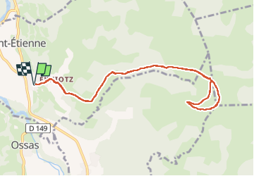
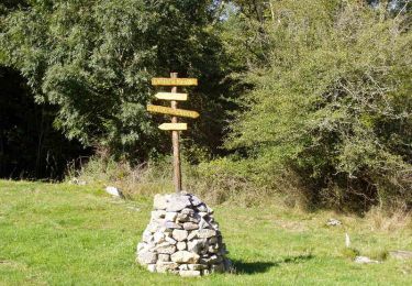
Trail Walking of 11 km to be discovered at New Aquitaine, Pyrénées-Atlantiques, Sauguis-Saint-Étienne. This trail is proposed by mitch1952.

Description

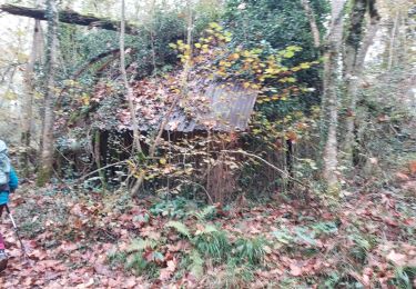
Trace de la randonnée à partir de Sauguis Saint Etienne arrivant à la Chapelle de la Madeleine par l'Ouest , validée pour un  G3 par le COVAR malgré un dénivelé de 619 mètres.
A noter que les tentatives de créer une boucle ont échoué, les différents chemins étant fermés à différents endroits.
Il existe un G2B arrivant à la Madeleine par le sud à partir de Tardets.

Elevation profile

Positioning

Country:
France
Region :
New Aquitaine
Department/Province :
Pyrénées-Atlantiques
Municipality :
Sauguis-Saint-Étienne
Location:
Unknown
Start:(UTM)
671705 ; 4779765 (30T) N.

Trails nearby

Trail On foot Ossas-Suhare - OSSAS SUHARE
On foot
GUIDE
marmotte65

On foot

Easy
Ossas-Suhare, New Aquitaine, Pyrénées-Atlantiques, France
9 km | 12.3 km-effort
2h 47min
Yes
Trail Walking Tardets-Sorholus - erretzü - Photo
Walking
boombop

Walking

Very difficult
Tardets-Sorholus, New Aquitaine, Pyrénées-Atlantiques, France
10.8 km | 17.1 km-effort
4h 1min
Yes
Trail Walking Tardets-Sorholus - erretzü - Photo
Walking
boombop

Walking

Very difficult
Tardets-Sorholus, New Aquitaine, Pyrénées-Atlantiques, France
10.8 km | 17.1 km-effort
4h 1min
Yes
Trail Walking Ossas-Suhare - Hegan Bürü - Ossas Suhare - Photo
Walking
tracegps

Walking

Difficult
Ossas-Suhare, New Aquitaine, Pyrénées-Atlantiques, France
6.6 km | 8.9 km-effort
3h 30min
No
Trail Walking Camou-Cihigue - Sentiers des Lamiñaks - Camou - Cihigue - Photo
Walking
tracegps

Walking

Difficult
Camou-Cihigue, New Aquitaine, Pyrénées-Atlantiques, France
12.4 km | 21 km-effort
5h 30min
Yes
Trail Walking Ossas-Suhare - ossas suhare G4FAIT  - Photo
Walking
LouisROGER

Walking

Difficult
Ossas-Suhare, New Aquitaine, Pyrénées-Atlantiques, France
9 km | 12.2 km-effort
4h 57min
Yes
Trail Walking Sauguis-Saint-Étienne - Trace Reco Sauguis Guy - Photo
Walking
mitch1952

Walking

Sauguis-Saint-Étienne, New Aquitaine, Pyrénées-Atlantiques, France
13.9 km | 24 km-effort
7h 40min
Yes
Trail Walking Tardets-Sorholus - Départ de Tardets - Photo
Walking
dudu79

Walking

Medium
Tardets-Sorholus, New Aquitaine, Pyrénées-Atlantiques, France
13.3 km | 24 km-effort
24h 5min
Yes
Trail Walking Ossas-Suhare - Trace G4 Ossas Suhare Guy - Photo
Walking
mitch1952

Walking

Ossas-Suhare, New Aquitaine, Pyrénées-Atlantiques, France
9.8 km | 13.1 km-effort
5h 3min
Yes


Close
My subscriptions