


meouge 15.8kms 754m

Danielba
User GUIDE
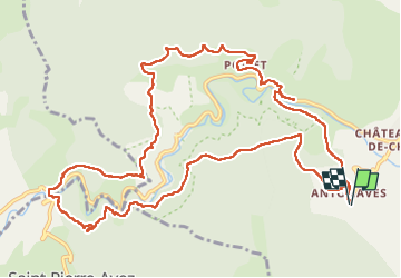

Length
15.1 km

Max alt
783 m

Uphill gradient
638 m
Km-Effort
24 km

Min alt
556 m

Downhill gradient
636 m
Boucle
Yes
Creation date :
2024-03-19 08:05:38.925
Updated on :
2024-03-19 15:24:03.656
7h01
Difficulty : Medium

FREE GPS app for hiking
 SityTrail
IGN / Geographical institutes
SityTrail Plus
The world is yours!
About
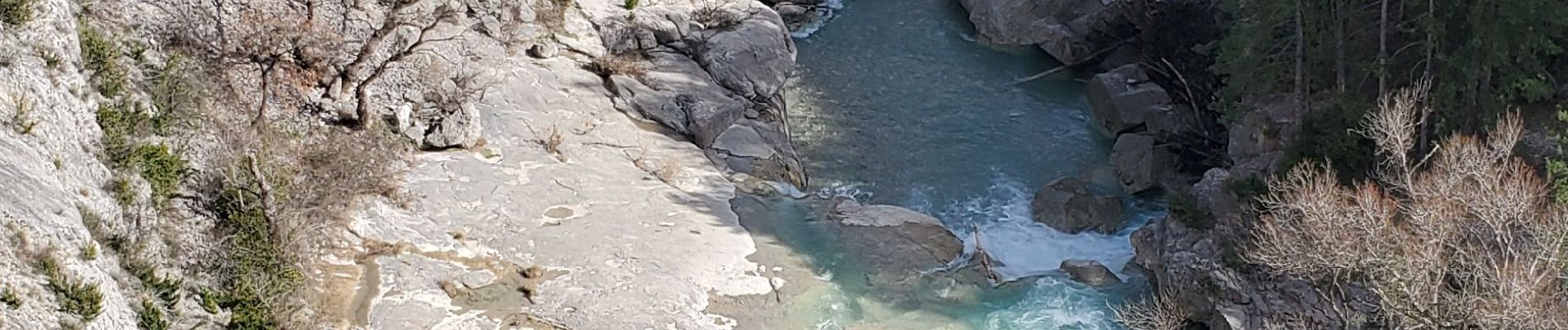
Trail Walking of 15.1 km to be discovered at Provence-Alpes-Côte d'Azur, Hautes-Alpes, Val-Buëch-Méouge. This trail is proposed by Danielba .
Photos


Positioning
Country:
France
Region :
Provence-Alpes-Côte d'Azur
Department/Province :
Hautes-Alpes
Municipality :
Val-Buëch-Méouge
Location:
Antonaves
Start:(Dec)
Start:(UTM)
723835 ; 4905151 (31T) N.
Comments