


Trace M1 Berges du Gave Guy

mitch1952
User
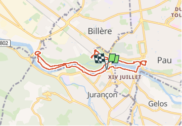

Length
9.6 km

Max alt
208 m

Uphill gradient
103 m
Km-Effort
11 km

Min alt
163 m

Downhill gradient
104 m
Boucle
Yes
Creation date :
2024-03-24 13:46:43.0
Updated on :
2024-03-24 16:19:55.542

FREE GPS app for hiking
 SityTrail
IGN / Geographical institutes
SityTrail Plus
The world is yours!
About
Trail of 9.6 km to be discovered at New Aquitaine, Pyrénées-Atlantiques, Jurançon. This trail is proposed by mitch1952.
Positioning
Country:
France
Region :
New Aquitaine
Department/Province :
Pyrénées-Atlantiques
Municipality :
Jurançon
Location:
Unknown
Start:(Dec)
Start:(UTM)
711874 ; 4796704 (30T) N.
Comments