


Joussé Le chemin des gentilhommieres

Rembliere
User

Length
10.3 km

Max alt
169 m

Uphill gradient
119 m
Km-Effort
11.9 km

Min alt
131 m

Downhill gradient
119 m
Boucle
Yes
Creation date :
2024-03-29 16:41:38.187
Updated on :
2024-03-29 16:44:21.369
2h41
Difficulty : Medium

FREE GPS app for hiking
 SityTrail
IGN / Geographical institutes
SityTrail Plus
The world is yours!
About
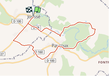
Trail Walking of 10.3 km to be discovered at New Aquitaine, Vienne, Joussé. This trail is proposed by Rembliere.
Positioning
Country:
France
Region :
New Aquitaine
Department/Province :
Vienne
Municipality :
Joussé
Location:
Unknown
Start:(Dec)
Start:(UTM)
304981 ; 5122399 (31T) N.
Comments