Trail Walking Lucheux - Lucheux - l'allée royale - Photo

Lucheux - l'allée royale

© OpenStreetMap contributors
Length
Length
10.1 km
Max alt
Max alt
172 m
Uphill gradient
Uphill gradient
143 m
Km-Effort
Km-Effort  
12 km
Min alt
Min alt
84 m
Downhill gradient
Downhill gradient
142 m
Boucle
Boucle
Yes
Creation date :
2024-03-31 11:42:26.833
Updated on :
2024-03-31 11:49:07.723

(0 Reviews)

Walking
Walking
2h44
Difficulty : Difficult

Scan this QR Code to open this trail in the SityTrail application

FREE GPS app for hiking

Logo SityTrail SityTrail

IGN / Geographical institutes

Download SityTrail from the App Store Download SityTrail from Google Play

Logo SityTrail SityTrail World

The world is yours!

Download SityTrail from the App Store Download SityTrail from Google Play Download SityTrail on Huawei AppGallery

About

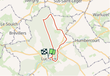
Trail Walking of 10.1 km to be discovered at Hauts-de-France, Somme, Lucheux. This trail is proposed by temmichel.

Description

Cette randonnée emprunte en grande partie le GR 124 puis en forêt au croisement avec la voie royale que vous epour rejoindre votre point de départ situé face au château. Vous pourrez admirer sur la voie royale de magnifiques hêtres qui font le charme de cette forêt que je vous enjoins à parcourir
Quiétude et sérénité assurées
Bonne rando
Jean-Michel

Elevation profile

Photos

Positioning

Country:
France
Region :
Hauts-de-France
Department/Province :
Somme
Municipality :
Lucheux
Location:
Unknown
Start:(UTM)
457951 ; 5560714 (31U) N.

Trails nearby

Trail Walking Sus-Saint-Léger - Sentier du Petit Dieu - Sus-Saint-Léger - Photo
Walking
tracegps

Walking

Medium
Sus-Saint-Léger, Hauts-de-France, Pas-de-Calais, France
11.8 km | 12.9 km-effort
2h 55min
Yes
Trail Cycle Doullens - Le Doullennais - Photo
Cycle
tracegps

Cycle

Difficult
Doullens, Hauts-de-France, Somme, France
51 km | 58 km-effort
3h 30min
Yes
Trail Walking Warluzel - Le sentier des deux sources. (Warluzel) - Photo
Walking
tracegps

Walking

Difficult
Warluzel, Hauts-de-France, Pas-de-Calais, France
13.4 km | 15.1 km-effort
3h 19min
Yes
Trail Walking Grouches-Luchuel - Grouches Luchuel - Photo
Walking
jpblimond

Walking

Easy
Grouches-Luchuel, Hauts-de-France, Somme, France
14.6 km | 17.4 km-effort
3h 41min
Yes
Trail Other activity Doullens - Picardie - Ligne 306 - Doullens - Arras (Section Doullens Halloy) - Photo
Other activity
mich54

Other activity

Very easy
Doullens, Hauts-de-France, Somme, France
7.9 km | 9.1 km-effort
5min
No
Trail Other activity Doullens - Nord - Pas-de-Calais - Ligne 306 - Doullens - Arras - Photo
Other activity
mich54

Other activity

Very easy
Doullens, Hauts-de-France, Somme, France
35 km | 38 km-effort
5min
No
Trail Walking Sus-Saint-Léger - LUCHEUX et sa forêt - Photo
Walking
camino59

Walking

Easy
Sus-Saint-Léger, Hauts-de-France, Pas-de-Calais, France
14.8 km | 17.2 km-effort
3h 49min
Yes
Trail Motor Lucheux - pas en Artois après midi 240313 - Photo
Motor
beta

Motor

Difficult
Lucheux, Hauts-de-France, Somme, France
33 km | 39 km-effort
2h 42min
No
Trail Walking Warluzel - Warluzel 7,7 km - Photo
Walking
Barney62

Walking

Medium
Warluzel, Hauts-de-France, Pas-de-Calais, France
7.7 km | 8.6 km-effort
1h 54min
Yes


Close
My subscriptions