


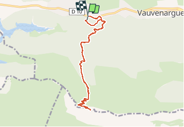
Ste victoire - chemin Venturier

mhetpierre
User

Length
10.1 km

Max alt
902 m

Uphill gradient
575 m
Km-Effort
17.7 km

Min alt
348 m

Downhill gradient
563 m
Boucle
Yes
Creation date :
2018-08-18 15:30:31.995
Updated on :
2018-08-18 15:30:31.995
3h01
Difficulty : Medium

FREE GPS app for hiking
 SityTrail
IGN / Geographical institutes
SityTrail Plus
The world is yours!
About
Trail Walking of 10.1 km to be discovered at Provence-Alpes-Côte d'Azur, Bouches-du-Rhône, Vauvenargues. This trail is proposed by mhetpierre.
Positioning
Country:
France
Region :
Provence-Alpes-Côte d'Azur
Department/Province :
Bouches-du-Rhône
Municipality :
Vauvenargues
Location:
Unknown
Start:(Dec)
Start:(UTM)
708310 ; 4825482 (31T) N.
Comments