


Burnhaupt Bas

ROPPJP
User
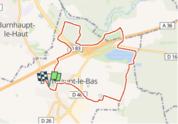

Length
9.9 km

Max alt
305 m

Uphill gradient
80 m
Km-Effort
11 km

Min alt
275 m

Downhill gradient
81 m
Boucle
Yes
Creation date :
2024-04-05 11:52:50.677
Updated on :
2024-04-05 14:53:48.915
3h00
Difficulty : Medium

FREE GPS app for hiking
 SityTrail
IGN / Geographical institutes
SityTrail Plus
The world is yours!
About
Trail Walking of 9.9 km to be discovered at Grand Est, Haut-Rhin, Burnhaupt-le-Bas. This trail is proposed by ROPPJP.
Photos


Positioning
Country:
France
Region :
Grand Est
Department/Province :
Haut-Rhin
Municipality :
Burnhaupt-le-Bas
Location:
Unknown
Start:(Dec)
Start:(UTM)
361850 ; 5286614 (32T) N.
Comments