


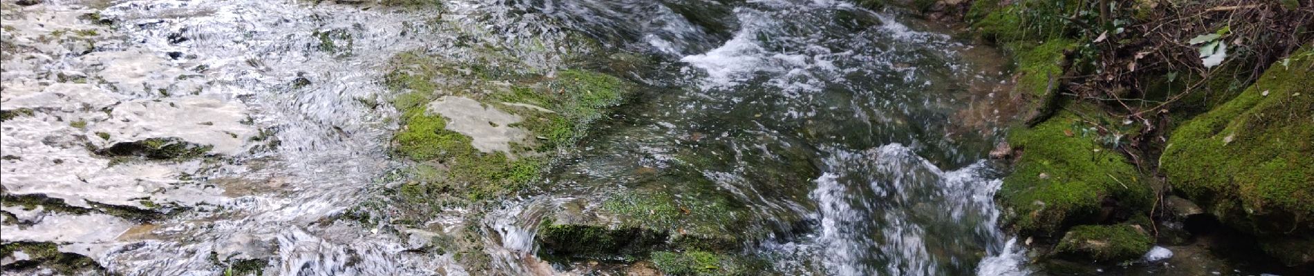
les Encanaux

cousam
User
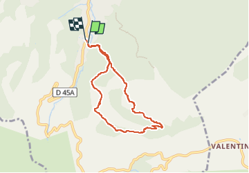

Length
7.1 km

Max alt
534 m

Uphill gradient
297 m
Km-Effort
11 km

Min alt
246 m

Downhill gradient
291 m
Boucle
Yes
Creation date :
2024-04-06 07:12:50.94
Updated on :
2024-04-06 13:56:22.815
2h14
Difficulty : Difficult

FREE GPS app for hiking
 SityTrail
IGN / Geographical institutes
SityTrail Plus
The world is yours!
About
Trail Walking of 7.1 km to be discovered at Provence-Alpes-Côte d'Azur, Bouches-du-Rhône, Auriol. This trail is proposed by cousam.
Description
Au KM 2.7 pour éviter de monter l'échelle de corde (hard), faire 1/2 tour sur 50m pour contourner( la vasque) par une sente (cairn).
Photos


Positioning
Country:
France
Region :
Provence-Alpes-Côte d'Azur
Department/Province :
Bouches-du-Rhône
Municipality :
Auriol
Location:
Unknown
Start:(Dec)
Start:(UTM)
715598 ; 4803148 (31T) N.
Comments