


Vallée de Champoléon

frizou83
User
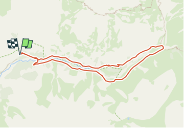

Length
9.1 km

Max alt
1828 m

Uphill gradient
364 m
Km-Effort
14 km

Min alt
1480 m

Downhill gradient
365 m
Boucle
Yes
Creation date :
2024-04-06 15:43:03.364
Updated on :
2024-04-06 15:43:57.136
3h10
Difficulty : Difficult

FREE GPS app for hiking
 SityTrail
IGN / Geographical institutes
SityTrail Plus
The world is yours!
About
Trail Walking of 9.1 km to be discovered at Provence-Alpes-Côte d'Azur, Hautes-Alpes, Champoléon. This trail is proposed by frizou83.


Positioning
Country:
France
Region :
Provence-Alpes-Côte d'Azur
Department/Province :
Hautes-Alpes
Municipality :
Champoléon
Location:
Unknown
Start:(Dec)
Start:(UTM)
284791 ; 4960229 (32T) N.
Comments