


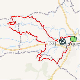
FOURQUES 66 - les chemins d'Adrienne

jeff66
User

Length
12.8 km

Max alt
182 m

Uphill gradient
155 m
Km-Effort
14.9 km

Min alt
119 m

Downhill gradient
152 m
Boucle
Yes
Creation date :
2015-05-21 00:00:00.0
Updated on :
2015-05-21 00:00:00.0
2h22
Difficulty : Easy

FREE GPS app for hiking
 SityTrail
IGN / Geographical institutes
SityTrail Plus
The world is yours!
About
Trail Walking of 12.8 km to be discovered at Occitania, Pyrénées-Orientales, Fourques. This trail is proposed by jeff66.
Positioning
Country:
France
Region :
Occitania
Department/Province :
Pyrénées-Orientales
Municipality :
Fourques
Location:
Unknown
Start:(Dec)
Start:(UTM)
481855 ; 4714422 (31T) N.
Comments