


Rando marcheurs 11 04 2024rando

Hubert Neff
User
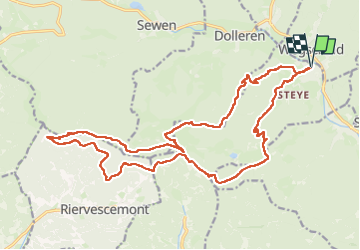

Length
23 km

Max alt
1070 m

Uphill gradient
1097 m
Km-Effort
38 km

Min alt
454 m

Downhill gradient
1096 m
Boucle
Yes
Creation date :
2024-04-11 07:10:43.0
Updated on :
2024-04-12 08:06:21.698

FREE GPS app for hiking
 SityTrail
IGN / Geographical institutes
SityTrail Plus
The world is yours!
About
Trail of 23 km to be discovered at Grand Est, Haut-Rhin, Kirchberg. This trail is proposed by Hubert Neff.
Description
Rando lochberg
Positioning
Country:
France
Region :
Grand Est
Department/Province :
Haut-Rhin
Municipality :
Kirchberg
Location:
Unknown
Start:(Dec)
Start:(UTM)
347037 ; 5295827 (32T) N.
Comments