


nt

Phidel66
User

Length
42 m

Max alt
754 m

Uphill gradient
0 m
Km-Effort
42 m

Min alt
754 m

Downhill gradient
0 m
Boucle
No
Creation date :
2024-04-12 13:30:03.148
Updated on :
2024-04-12 14:31:31.343
2m
Difficulty : Easy

FREE GPS app for hiking
 SityTrail
IGN / Geographical institutes
SityTrail Plus
The world is yours!
About
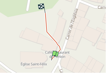
Trail Walking of 42 m to be discovered at Occitania, Pyrénées-Orientales, Fillols. This trail is proposed by Phidel66.
Description
r
Positioning
Country:
France
Region :
Occitania
Department/Province :
Pyrénées-Orientales
Municipality :
Fillols
Location:
Unknown
Start:(Dec)
Start:(UTM)
451476 ; 4712265 (31T) N.
Comments