Trail Walking Genappe - Ferme du Foriet- Nivelles   - Photo

Ferme du Foriet- Nivelles

© OpenStreetMap contributors
Length
Length
7.6 km
Max alt
Max alt
154 m
Uphill gradient
Uphill gradient
39 m
Km-Effort
Km-Effort  
8.3 km
Min alt
Min alt
103 m
Downhill gradient
Downhill gradient
84 m
Boucle
Boucle
No
Creation date :
2024-04-13 11:36:36.6
Updated on :
2024-04-13 14:08:50.195

(0 Reviews)

Walking
Walking
1h54
Difficulty : Medium

Scan this QR Code to open this trail in the SityTrail application

FREE GPS app for hiking

Logo SityTrail SityTrail

IGN / Geographical institutes

Download SityTrail from the App Store Download SityTrail from Google Play

Logo SityTrail SityTrail World

The world is yours!

Download SityTrail from the App Store Download SityTrail from Google Play Download SityTrail on Huawei AppGallery

About

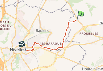
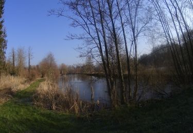
Trail Walking of 7.6 km to be discovered at Wallonia, Walloon Brabant, Genappe. This trail is proposed by Mady Lambert.

Description

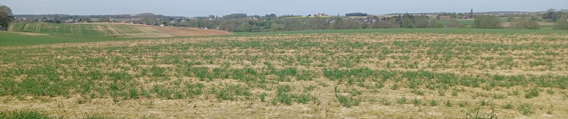
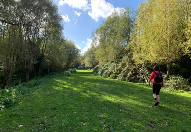
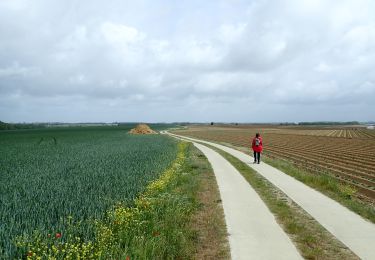
Démarrer au carrefour de la route de Lillois et du chemin du Pirot, rejoindre l'église de Thines par les champs, rester dans les champs en parallèle de la chaussée  de Namur, zigzaguer dans la Maillebotte par des petits sentiers, rejoindre la rue du Malgras, suivre le plan pour arriver rue Delfosse. Bonnes chaussures, à boire, chien obéissant en liberté presque tout le temps.

Elevation profile

Photos

Positioning

Country:
Belgium
Region :
Wallonia
Department/Province :
Walloon Brabant
Municipality :
Genappe
Location:
Vieux-Genappe
Start:(UTM)
598692 ; 5608537 (31U) N.

Trails nearby

Trail Mountain bike Lasne - maransart - Photo
Mountain bike
GUIDE
pascalou73

Mountain bike

Difficult
(1)
Lasne, Wallonia, Walloon Brabant, Belgium
40 km | 49 km-effort
Unknown
Yes
Trail Mountain bike Lasne - VTT a plancenoit - Photo
Mountain bike
GUIDE
pascalou73

Mountain bike

Difficult
(1)
Lasne, Wallonia, Walloon Brabant, Belgium
28 km | 34 km-effort
2h 20min
Yes
Trail Walking Lasne - RB 11 Plancenoit - Lasnes - Photo
Walking
jregin

Walking

Easy
(1)
Lasne, Wallonia, Walloon Brabant, Belgium
12.8 km | 15.6 km-effort
2h 42min
Yes
Trail On foot Genappe - #200523 - Loncée, Vallée de la Haute Dyle et Houtain*** - Photo
On foot
Randos Ouvertes

On foot

Very easy
(2)
Genappe, Wallonia, Walloon Brabant, Belgium
8.2 km | 9.3 km-effort
2h 0min
Yes
Trail Walking Genappe - Loupoigne 06 03 2018 Nathalie Demain - Photo
Walking
ThierryGABRIEL

Walking

Easy
(2)
Genappe, Wallonia, Walloon Brabant, Belgium
11.2 km | 12.7 km-effort
4h 12min
Yes
Trail Walking Lasne - Francine  - Photo
Walking
Criscoy

Walking

Medium
(1)
Lasne, Wallonia, Walloon Brabant, Belgium
9.3 km | 11.5 km-effort
2h 59min
Yes
Trail Walking Lasne - Promenade a partir du monument prussien - Photo
Walking
samlrando

Walking

Very easy
(1)
Lasne, Wallonia, Walloon Brabant, Belgium
4.8 km | 5.4 km-effort
1h 27min
Yes
Trail Walking Nivelles - #230703 - Baulers, champ de Florifontaine - Photo
Walking
Randos Ouvertes

Walking

Medium
(1)
Nivelles, Wallonia, Walloon Brabant, Belgium
6.7 km | 7.6 km-effort
1h 43min
Yes
Trail Mountain bike Lasne - Lasne_20220306_082951 - Photo
Mountain bike
GUIDE
pascalou73

Mountain bike

Very difficult
Lasne, Wallonia, Walloon Brabant, Belgium
41 km | 51 km-effort
3h 30min
Yes


Close
My subscriptions