


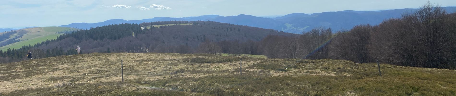
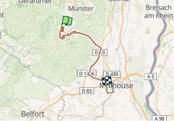
24 04 14 autour d’Uffrain

jmbilger
User

Length
70 km

Max alt
1307 m

Uphill gradient
782 m
Km-Effort
83 km

Min alt
238 m

Downhill gradient
1683 m
Boucle
No
Creation date :
2024-04-14 11:19:37.0
Updated on :
2024-04-14 17:29:10.115
3h45
Difficulty : Unknown

FREE GPS app for hiking
 SityTrail
IGN / Geographical institutes
SityTrail Plus
The world is yours!
About
Trail Walking of 70 km to be discovered at Grand Est, Haut-Rhin, Metzeral. This trail is proposed by jmbilger.
Description
D
Photos


Positioning
Country:
France
Region :
Grand Est
Department/Province :
Haut-Rhin
Municipality :
Metzeral
Location:
Unknown
Start:(Dec)
Start:(UTM)
352383 ; 5312923 (32T) N.
Comments