


2024-04-17_22h19m13_refuge-du-mont-thabor

oliviergau
User
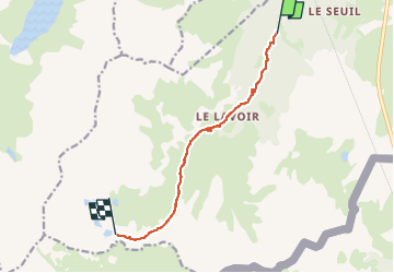

Length
8.5 km

Max alt
2497 m

Uphill gradient
881 m
Km-Effort
17.3 km

Min alt
1617 m

Downhill gradient
6 m
Boucle
No
Creation date :
2024-04-17 20:19:14.182
Updated on :
2024-04-17 20:19:14.545

FREE GPS app for hiking
 SityTrail
IGN / Geographical institutes
SityTrail Plus
The world is yours!
About
Trail of 8.5 km to be discovered at Auvergne-Rhône-Alpes, Savoy, Modane. This trail is proposed by oliviergau.
Positioning
Country:
France
Region :
Auvergne-Rhône-Alpes
Department/Province :
Savoy
Municipality :
Modane
Location:
Unknown
Start:(Dec)
Start:(UTM)
315337 ; 5004308 (32T) N.
Comments