


roisan blavy

veroarvinberod
User
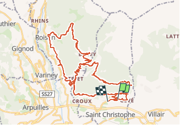

Length
40 km

Max alt
1557 m

Uphill gradient
1733 m
Km-Effort
63 km

Min alt
746 m

Downhill gradient
1740 m
Boucle
No
Creation date :
2024-04-16 10:21:08.095
Updated on :
2024-04-18 06:01:56.005
4h39
Difficulty : Very difficult

FREE GPS app for hiking
 SityTrail
IGN / Geographical institutes
SityTrail Plus
The world is yours!
About
Trail Mountain bike of 40 km to be discovered at Aosta Valley, Unknown, Saint-Christophe. This trail is proposed by veroarvinberod.
Positioning
Country:
Italy
Region :
Aosta Valley
Department/Province :
Unknown
Municipality :
Saint-Christophe
Location:
Unknown
Start:(Dec)
Start:(UTM)
372554 ; 5068108 (32T) N.
Comments