Trail Walking Avanne-Aveney - AVANNE AVENEY RANCENAY TOUR MONTFERRAND AVANNE - Photo

AVANNE AVENEY RANCENAY TOUR MONTFERRAND AVANNE

 micbesac
micbesac

User

© OpenStreetMap contributors
Length
Length
13.6 km
Max alt
Max alt
340 m
Uphill gradient
Uphill gradient
309 m
Km-Effort
Km-Effort  
17.8 km
Min alt
Min alt
228 m
Downhill gradient
Downhill gradient
312 m
Boucle
Boucle
Yes
Creation date :
2024-04-18 18:18:21.14
Updated on :
2024-04-18 18:22:36.757

(0 Reviews)

Walking
Walking
4h02
Difficulty : Difficult

Scan this QR Code to open this trail in the SityTrail application

FREE GPS app for hiking

Logo SityTrail SityTrail

IGN / Geographical institutes

Download SityTrail from the App Store Download SityTrail from Google Play

Logo SityTrail SityTrail World

The world is yours!

Download SityTrail from the App Store Download SityTrail from Google Play Download SityTrail on Huawei AppGallery

About

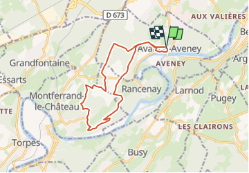
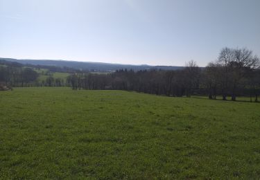
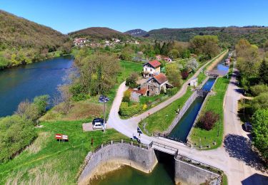
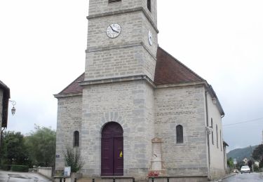
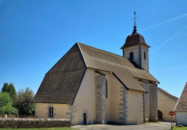
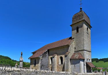
Trail Walking of 13.6 km to be discovered at Bourgogne-Franche-Comté, Doubs, Avanne-Aveney. This trail is proposed by micbesac.

Description

Départ parking stade d'Avanne aveney en empruntant le gr de pays du  GBM sentiers bois au, dessus de chemillet puis bois de la broze Rancenay vieux village Montferrand tour de montferrand retour par bois de la cote les aigrettes et avanne

Elevation profile

Positioning

Country:
France
Region :
Bourgogne-Franche-Comté
Department/Province :
Doubs
Municipality :
Avanne-Aveney
Location:
Unknown
Start:(UTM)
724317 ; 5231818 (31T) N.

Trails nearby

Trail Walking Beure - Beure de la pisseur au mercureau  - Photo
Walking
eltonnermou

Walking

Difficult
(1)
Beure, Bourgogne-Franche-Comté, Doubs, France
16.8 km | 24 km-effort
3h 48min
Yes
Trail Walking Serre-les-Sapins - serre les sapins la ménère - Photo
Walking
eltonnermou

Walking

Very easy
(1)
Serre-les-Sapins, Bourgogne-Franche-Comté, Doubs, France
10.4 km | 12.6 km-effort
1h 48min
Yes
Trail Walking Beure -
Walking
eltonnermou

Walking

Medium
(1)
Beure, Bourgogne-Franche-Comté, Doubs, France
15.7 km | 22 km-effort
6h 35min
Yes
Trail Walking Fontain - fontain - fort de Fontain - forêt de Fontain - Photo
Walking
eltonnermou

Walking

Very easy
(1)
Fontain, Bourgogne-Franche-Comté, Doubs, France
10.9 km | 14 km-effort
3h 11min
Yes
Trail On foot Busy - Sentier de la Pierre de Vorges - Photo
On foot
PRO

On foot

Easy
Busy, Bourgogne-Franche-Comté, Doubs, France
7.2 km | 9.4 km-effort
2h 8min
Yes
Trail On foot Vorges-les-Pins - Sentier des Crêtes - Photo
On foot
PRO

On foot

Easy
Vorges-les-Pins, Bourgogne-Franche-Comté, Doubs, France
4.2 km | 6.1 km-effort
1h 23min
Yes
Trail On foot Fontain - Grande Boucle de Fontain - Photo
On foot
PRO

On foot

Easy
Fontain, Bourgogne-Franche-Comté, Doubs, France
10 km | 13.2 km-effort
2h 59min
Yes
Trail On foot Fontain - Sentier des Grands Prés - Photo
On foot
PRO

On foot

Easy
Fontain, Bourgogne-Franche-Comté, Doubs, France
6.6 km | 9.6 km-effort
2h 10min
Yes
Trail On foot Grandfontaine - Sentier de Béthanier-la-Marne - Photo
On foot
PRO

On foot

Easy
Grandfontaine, Bourgogne-Franche-Comté, Doubs, France
8.5 km | 10.2 km-effort
2h 18min
Yes


Close
My subscriptions