


G4 Haut doloron

LouisROGER
User GUIDE
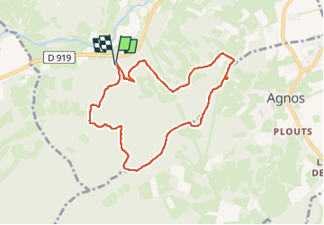

Length
8.6 km

Max alt
435 m

Uphill gradient
278 m
Km-Effort
12.3 km

Min alt
237 m

Downhill gradient
278 m
Boucle
Yes
Creation date :
2024-04-19 08:01:45.995
Updated on :
2024-04-19 13:17:55.4
5h14
Difficulty : Difficult

FREE GPS app for hiking
 SityTrail
IGN / Geographical institutes
SityTrail Plus
The world is yours!
About
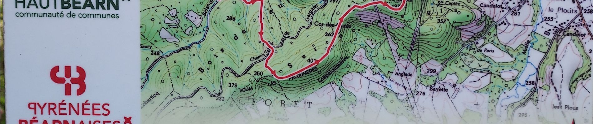
Trail Walking of 8.6 km to be discovered at New Aquitaine, Pyrénées-Atlantiques, Oloron-Sainte-Marie. This trail is proposed by LouisROGER.
Photos

Positioning
Country:
France
Region :
New Aquitaine
Department/Province :
Pyrénées-Atlantiques
Municipality :
Oloron-Sainte-Marie
Location:
Unknown
Start:(Dec)
Start:(UTM)
690875 ; 4782094 (30T) N.
Comments