Trail Nordic walking Municipal Unit of Argyroupoli - 2010-07-02 - 20h08m13 - Photo
© OpenStreetMap contributors
Length
Length
4.9 km
Max alt
Max alt
75 m
Uphill gradient
Uphill gradient
54 m
Km-Effort
Km-Effort  
5.6 km
Min alt
Min alt
34 m
Downhill gradient
Downhill gradient
58 m
Boucle
Boucle
Yes
Creation date :
2014-12-10 00:00:00.0
Updated on :
2014-12-10 00:00:00.0

(0 Reviews)

Nordic walking
Nordic walking
--
Difficulty : Unknown

Scan this QR Code to open this trail in the SityTrail application

FREE GPS app for hiking

Logo SityTrail SityTrail

IGN / Geographical institutes

Download SityTrail from the App Store Download SityTrail from Google Play

Logo SityTrail SityTrail World

The world is yours!

Download SityTrail from the App Store Download SityTrail from Google Play Download SityTrail on Huawei AppGallery

About

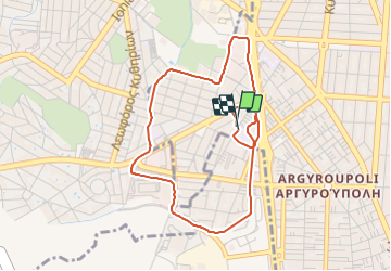
Trail Nordic walking of 4.9 km to be discovered at Attica, Regional Unit of South Athens, Municipal Unit of Argyroupoli. This trail is proposed by nontas2010.

Elevation profile

Photos

Points of interest

Point of interest Municipal Unit of Argyroupoli - Point 1 - Photo
nontas2010
MUNICIPAL UNIT OF ARGYROUPOLI 

Positioning

Country:
Greece
Region :
Attica
Department/Province :
Regional Unit of South Athens
Municipality :
Municipal Unit of Argyroupoli
Location:
Unknown
Start:(UTM)
741153 ; 4199349 (34S) N.

Trails nearby

Trail Nordic walking Municipal Unit of Argyroupoli - 2010-07-07 - 20h45m01 - Photo
Nordic walking
nontas2010

Nordic walking

Very easy
Municipal Unit of Argyroupoli, Attica, Regional Unit of South Athens, Greece
4.2 km | 4.8 km-effort
Unknown
Yes
Trail Other activity  - 20140428-Grèce - Photo
Other activity
sbouju

Other activity

Very easy
, Attica, Regional Unit of South Athens, Greece
566 km | 567 km-effort
Unknown
No


Close
My subscriptions