


Sortie hivernale 1er partie

cps46
User
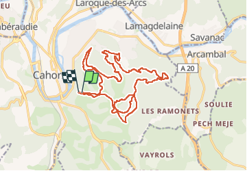

Length
22 km

Max alt
288 m

Uphill gradient
803 m
Km-Effort
33 km

Min alt
151 m

Downhill gradient
802 m
Boucle
Yes
Creation date :
2024-04-21 07:06:19.0
Updated on :
2024-04-21 10:35:38.231

FREE GPS app for hiking
 SityTrail
IGN / Geographical institutes
SityTrail Plus
The world is yours!
About
Trail of 22 km to be discovered at Occitania, Lot, Cahors. This trail is proposed by cps46.
Positioning
Country:
France
Region :
Occitania
Department/Province :
Lot
Municipality :
Cahors
Location:
Unknown
Start:(Dec)
Start:(UTM)
376890 ; 4922239 (31T) N.
Comments