Trail Walking La Romieu - J21_La Romieu - Condom - Photo

J21_La Romieu - Condom

 MAD-CVW
MAD-CVW

User

© OpenStreetMap contributors
Length
Length
14.6 km
Max alt
Max alt
216 m
Uphill gradient
Uphill gradient
275 m
Km-Effort
Km-Effort  
18.6 km
Min alt
Min alt
78 m
Downhill gradient
Downhill gradient
370 m
Boucle
Boucle
No
Creation date :
2024-04-23 07:04:20.802
Updated on :
2024-04-27 19:30:13.401

(0 Reviews)

Walking
Walking
3h25
Difficulty : Difficult

Scan this QR Code to open this trail in the SityTrail application

FREE GPS app for hiking

Logo SityTrail SityTrail

IGN / Geographical institutes

Download SityTrail from the App Store Download SityTrail from Google Play

Logo SityTrail SityTrail World

The world is yours!

Download SityTrail from the App Store Download SityTrail from Google Play Download SityTrail on Huawei AppGallery

About

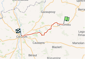
Trail Walking of 14.6 km to be discovered at Occitania, Gers, La Romieu. This trail is proposed by MAD-CVW.

Description

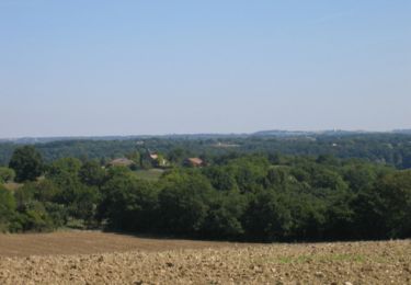
départ du village chats La Romieu au bar-resto par joli sentier aménagé en parallèle de la route, puis a travers champs valonnés, chemin enherbées et sentiers forestiers, de temps en temps la boue...
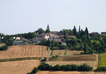
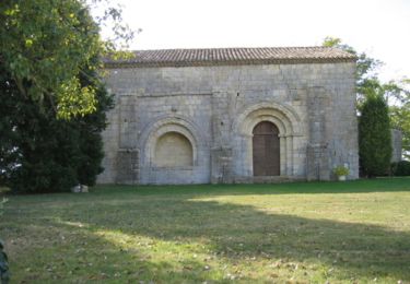
les paysages changent, des vignes,  et une petite chapelle en pleine nature dédiée à Ste Germaine.
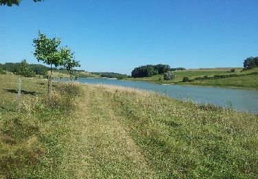
Encore quelques km et voilà le beau lac de Bousquetara.
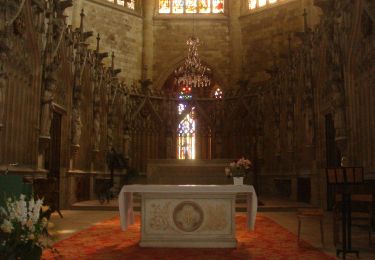
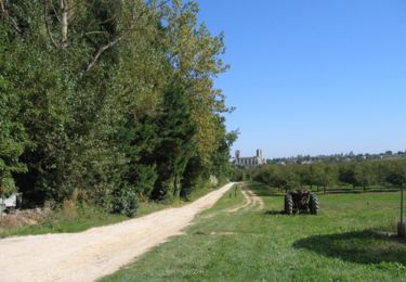
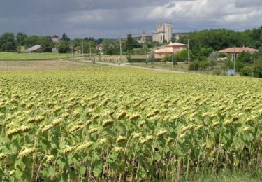
puis ligne droite, petite route et chemin, pour descendre sur Condom dont on aperçoit la cathédrale et la vieille église.
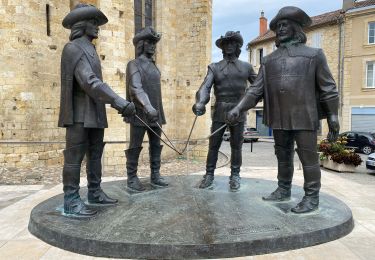
Direction centre ville pour saluer les mousquetaires devant la cathédrale.

Elevation profile

Positioning

Country:
France
Region :
Occitania
Department/Province :
Gers
Municipality :
La Romieu
Location:
Unknown
Start:(UTM)
299225 ; 4872950 (31T) N.

Trails nearby

Trail Walking Castelnau-sur-l'Auvignon - CC_Velay_EE_21_Castelnau-Auvignon_Montreal_20080821 - Photo
Walking
patrickdanilo

Walking

Easy
Castelnau-sur-l'Auvignon, Occitania, Gers, France
26 km | 32 km-effort
6h 54min
No
Trail Walking La Romieu - La Romieu Condom  - Photo
Walking
ghislaine.geffroy

Walking

Medium
(1)
La Romieu, Occitania, Gers, France
13.1 km | 16.8 km-effort
3h 7min
No
Trail Walking La Romieu - GR65 La Romieu > Condom - Photo
Walking
choubaka77

Walking

Easy
La Romieu, Occitania, Gers, France
16.3 km | 21 km-effort
6h 0min
No
Trail Walking La Romieu - En passant par le Marcasson - La Romieu - Photo
Walking
tracegps

Walking

Medium
La Romieu, Occitania, Gers, France
15.5 km | 20 km-effort
4h 0min
No
Trail Walking La Romieu - Anciens fiefs de Gascogne - La Romieu - Photo
Walking
tracegps

Walking

Medium
La Romieu, Occitania, Gers, France
16.7 km | 21 km-effort
4h 15min
Yes
Trail Walking La Romieu - Les palombières du Broustès - La Romieu - Photo
Walking
tracegps

Walking

Medium
La Romieu, Occitania, Gers, France
13.2 km | 16.5 km-effort
3h 30min
Yes
Trail Walking La Romieu - Les méandres du petit Auvignon - La Romieu - Photo
Walking
tracegps

Walking

Medium
La Romieu, Occitania, Gers, France
13.1 km | 16.1 km-effort
3h 30min
Yes
Trail Walking La Romieu - Sur le tronçon du patrimoine mondial - La Romieu - Photo
Walking
tracegps

Walking

Medium
La Romieu, Occitania, Gers, France
14.3 km | 18.3 km-effort
4h 0min
Yes
Trail Walking La Romieu - Trois sites (grotte - chapelle - falaise) - La Romieu - Photo
Walking
tracegps

Walking

Medium
(1)
La Romieu, Occitania, Gers, France
12.7 km | 15.6 km-effort
3h 0min
Yes


Close
My subscriptions