


lesgor

hartmannpat
User
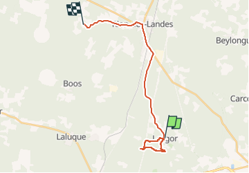

Length
22 km

Max alt
92 m

Uphill gradient
213 m
Km-Effort
25 km

Min alt
35 m

Downhill gradient
172 m
Boucle
No
Creation date :
2024-05-04 07:07:11.397
Updated on :
2024-05-04 09:33:26.904
2h26
Difficulty : Very difficult

FREE GPS app for hiking
 SityTrail
IGN / Geographical institutes
SityTrail Plus
The world is yours!
About
Trail Walking of 22 km to be discovered at New Aquitaine, Landes, Lesgor. This trail is proposed by hartmannpat.
Positioning
Country:
France
Region :
New Aquitaine
Department/Province :
Landes
Municipality :
Lesgor
Location:
Unknown
Start:(Dec)
Start:(UTM)
668727 ; 4857718 (30T) N.
Comments