


Landersen boucle

ROPPJP
User
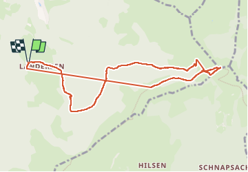

Length
9.5 km

Max alt
1266 m

Uphill gradient
572 m
Km-Effort
17.1 km

Min alt
761 m

Downhill gradient
571 m
Boucle
Yes
Creation date :
2024-05-04 11:24:43.967
Updated on :
2024-05-04 15:48:22.624
2h41
Difficulty : Difficult

FREE GPS app for hiking
 SityTrail
IGN / Geographical institutes
SityTrail Plus
The world is yours!
About
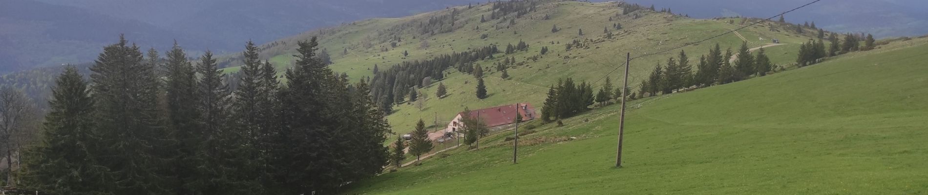
Trail Walking of 9.5 km to be discovered at Grand Est, Haut-Rhin, Sondernach. This trail is proposed by ROPPJP.
Photos


Positioning
Country:
France
Region :
Grand Est
Department/Province :
Haut-Rhin
Municipality :
Sondernach
Location:
Unknown
Start:(Dec)
Start:(UTM)
356623 ; 5316059 (32T) N.
Comments