


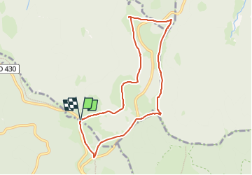
Parking Col de Hahnenbrunnen - Breitfirst - Lauchenkopf - Nondelkopf - Uffrain - Saltzbach et retour

patrickbeyrath
User

Length
7.9 km

Max alt
1307 m

Uphill gradient
229 m
Km-Effort
10.9 km

Min alt
1159 m

Downhill gradient
228 m
Boucle
Yes
Creation date :
2024-05-09 07:10:34.825
Updated on :
2024-05-09 07:25:17.775
2h28
Difficulty : Medium

FREE GPS app for hiking
 SityTrail
IGN / Geographical institutes
SityTrail Plus
The world is yours!
About
Trail Walking of 7.9 km to be discovered at Grand Est, Haut-Rhin, Metzeral. This trail is proposed by patrickbeyrath.
Positioning
Country:
France
Region :
Grand Est
Department/Province :
Haut-Rhin
Municipality :
Metzeral
Location:
Unknown
Start:(Dec)
Start:(UTM)
352146 ; 5312842 (32T) N.
Comments