


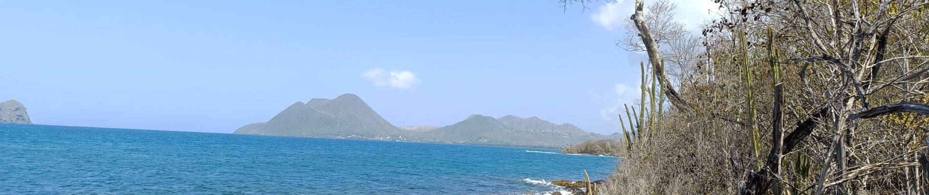
le Diamant de Taupinière vers O'mulane bas.

GabyG
User GUIDE

Length
5 km

Max alt
19 m

Uphill gradient
42 m
Km-Effort
5.5 km

Min alt
0 m

Downhill gradient
41 m
Boucle
Yes
Creation date :
2024-05-12 12:57:30.255
Updated on :
2024-05-12 15:03:19.085
2h05
Difficulty : Easy

FREE GPS app for hiking
 SityTrail
IGN / Geographical institutes
SityTrail Plus
The world is yours!
About
Trail Walking of 5 km to be discovered at Martinique, Unknown, Le Diamant. This trail is proposed by GabyG.
Description
Randonnées du dimanche, visite de la mangrove rose.
Photos


24 photos in total. Please click on a photo to see them all in the gallery.
Positioning
Country:
France
Region :
Martinique
Department/Province :
Unknown
Municipality :
Le Diamant
Location:
Unknown
Start:(Dec)
Start:(UTM)
716422 ; 1601802 (20P) N.
Comments