


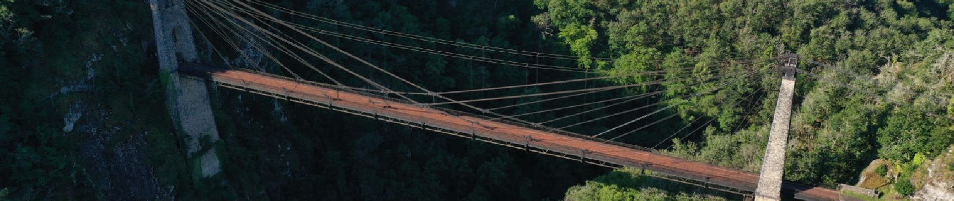
Boucle - Viaduc des rochers noirs

jagarnier
User GUIDE
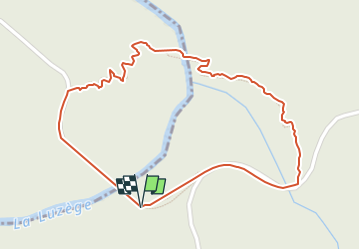

Length
1.3 km

Max alt
402 m

Uphill gradient
114 m
Km-Effort
2.7 km

Min alt
313 m

Downhill gradient
83 m
Boucle
Yes
Creation date :
2024-05-13 09:44:06.447
Updated on :
2024-05-13 09:54:02.128
45m
Difficulty : Medium

FREE GPS app for hiking
 SityTrail
IGN / Geographical institutes
SityTrail Plus
The world is yours!
About
Trail Walking of 1.3 km to be discovered at New Aquitaine, Corrèze, Soursac. This trail is proposed by jagarnier.
Photos

Positioning
Country:
France
Region :
New Aquitaine
Department/Province :
Corrèze
Municipality :
Soursac
Location:
Unknown
Start:(Dec)
Start:(UTM)
435917 ; 5013011 (31T) N.
Comments