


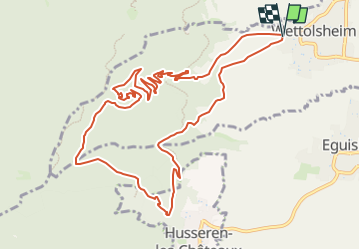
wettolsheim et chateaux

OxygenLT
User

Length
12.5 km

Max alt
615 m

Uphill gradient
469 m
Km-Effort
18.8 km

Min alt
228 m

Downhill gradient
471 m
Boucle
Yes
Creation date :
2024-05-16 11:05:23.3
Updated on :
2024-07-16 14:59:49.962
4h15
Difficulty : Difficult

FREE GPS app for hiking
 SityTrail
IGN / Geographical institutes
SityTrail Plus
The world is yours!
About
Trail Walking of 12.5 km to be discovered at Grand Est, Haut-Rhin, Wettolsheim. This trail is proposed by OxygenLT.
Positioning
Country:
France
Region :
Grand Est
Department/Province :
Haut-Rhin
Municipality :
Wettolsheim
Location:
Unknown
Start:(Dec)
Start:(UTM)
372980 ; 5324079 (32U) N.
Comments