


G3BEDOUS2024

LouisROGER
User GUIDE
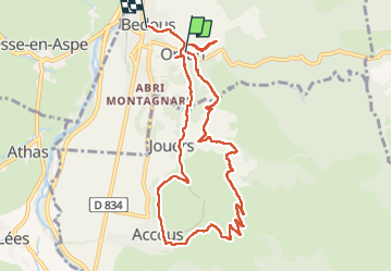

Length
10.9 km

Max alt
805 m

Uphill gradient
508 m
Km-Effort
17.7 km

Min alt
416 m

Downhill gradient
522 m
Boucle
No
Creation date :
2024-05-17 08:00:08.872
Updated on :
2024-05-17 13:28:16.355
5h26
Difficulty : Difficult

FREE GPS app for hiking
 SityTrail
IGN / Geographical institutes
SityTrail Plus
The world is yours!
About
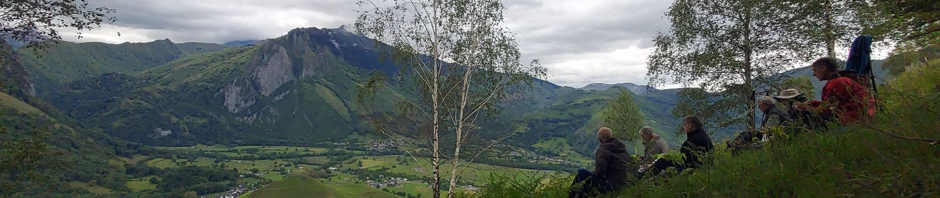
Trail Walking of 10.9 km to be discovered at New Aquitaine, Pyrénées-Atlantiques, Bedous. This trail is proposed by LouisROGER.
Photos

Positioning
Country:
France
Region :
New Aquitaine
Department/Province :
Pyrénées-Atlantiques
Municipality :
Bedous
Location:
Unknown
Start:(Dec)
Start:(UTM)
696095 ; 4763182 (30T) N.
Comments