


Mct

viaul
User GUIDE
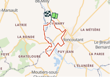

Length
10.1 km

Max alt
193 m

Uphill gradient
94 m
Km-Effort
11.3 km

Min alt
155 m

Downhill gradient
88 m
Boucle
Yes
Creation date :
2024-05-19 12:30:48.0
Updated on :
2024-05-19 14:44:40.299

FREE GPS app for hiking
 SityTrail
IGN / Geographical institutes
SityTrail Plus
The world is yours!
About
Trail of 10.1 km to be discovered at New Aquitaine, Deux-Sèvres, Moncoutant-sur-Sèvre. This trail is proposed by viaul.
Positioning
Country:
France
Region :
New Aquitaine
Department/Province :
Deux-Sèvres
Municipality :
Moncoutant-sur-Sèvre
Location:
Moncoutant
Start:(Dec)
Start:(UTM)
682458 ; 5178566 (30T) N.
Comments