


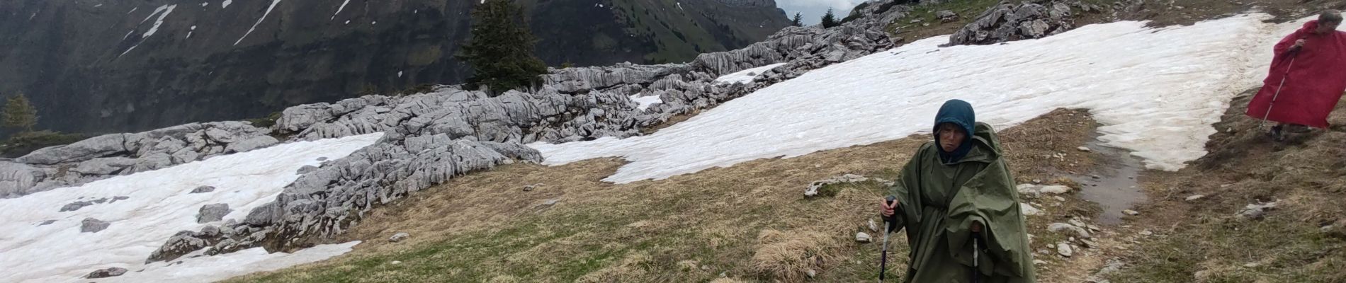
Annecy jour 3

Superpape
User
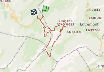

Length
16.7 km

Max alt
1800 m

Uphill gradient
793 m
Km-Effort
27 km

Min alt
1410 m

Downhill gradient
804 m
Boucle
No
Creation date :
2024-05-21 08:40:40.529
Updated on :
2024-05-21 15:48:36.74
7h07
Difficulty : Very difficult

FREE GPS app for hiking
 SityTrail
IGN / Geographical institutes
SityTrail Plus
The world is yours!
About
Trail Walking of 16.7 km to be discovered at Auvergne-Rhône-Alpes, Upper Savoy, Fillière. This trail is proposed by Superpape.
Photos

Positioning
Country:
France
Region :
Auvergne-Rhône-Alpes
Department/Province :
Upper Savoy
Municipality :
Fillière
Location:
Thorens-Glières
Start:(Dec)
Start:(UTM)
293256 ; 5093772 (32T) N.
Comments