


24 05 26 col Sommerseite -lachtelweier

jmbilger
User
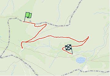

Length
4.1 km

Max alt
1010 m

Uphill gradient
19 m
Km-Effort
5.2 km

Min alt
759 m

Downhill gradient
259 m
Boucle
No
Creation date :
2024-05-26 11:46:44.0
Updated on :
2024-05-26 14:01:06.082
1h11
Difficulty : Unknown

FREE GPS app for hiking
 SityTrail
IGN / Geographical institutes
SityTrail Plus
The world is yours!
About
Trail Walking of 4.1 km to be discovered at Grand Est, Haut-Rhin, Kirchberg. This trail is proposed by jmbilger.
Positioning
Country:
France
Region :
Grand Est
Department/Province :
Haut-Rhin
Municipality :
Kirchberg
Location:
Unknown
Start:(Dec)
Start:(UTM)
343807 ; 5294462 (32T) N.
Comments