


Le Tour d Paulilles par Banyuls

Phidel66
User
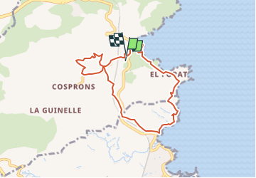

Length
8 km

Max alt
72 m

Uphill gradient
212 m
Km-Effort
10.9 km

Min alt
0 m

Downhill gradient
212 m
Boucle
Yes
Creation date :
2024-05-28 04:24:57.533
Updated on :
2024-05-28 04:26:05.074
2h28
Difficulty : Medium

FREE GPS app for hiking
 SityTrail
IGN / Geographical institutes
SityTrail Plus
The world is yours!
About
Trail Walking of 8 km to be discovered at Occitania, Pyrénées-Orientales, Port-Vendres. This trail is proposed by Phidel66.
Description
Romarins
Positioning
Country:
France
Region :
Occitania
Department/Province :
Pyrénées-Orientales
Municipality :
Port-Vendres
Location:
Unknown
Start:(Dec)
Start:(UTM)
509857 ; 4705473 (31T) N.
Comments