


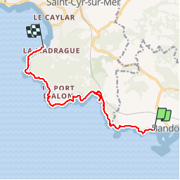

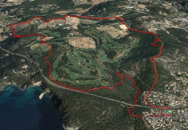
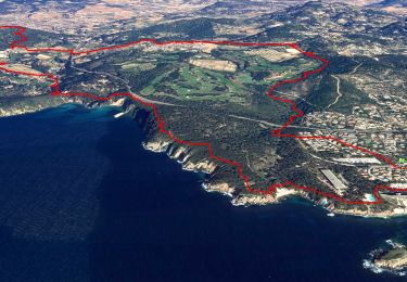
8.7 km | 11.4 km-effort


User GUIDE


FREE GPS app for hiking
 SityTrail
IGN / Geographical institutes
SityTrail World
The world is yours!
Trail Walking of 11.9 km to be discovered at Provence-Alpes-Côte d'Azur, Var, Bandol. This trail is proposed by R@ph.
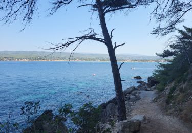
Le sentier du littoral au départ de Bandol vers les Lecques avec la descente vers le sous-marin de la Galère. Le parcours offre des points de vue magnifiques et par beau temps des couleurs de terres et de mer superbes.
Walking
Walking

Walking

Walking

Walking

Walking

Walking

Walking
Walking