Trail Walking Cappy - Circuit entre Terre et Eaux - Photo

Circuit entre Terre et Eaux

 corsinou
corsinou

User

© OpenStreetMap contributors
Length
Length
12.7 km
Max alt
Max alt
101 m
Uphill gradient
Uphill gradient
187 m
Km-Effort
Km-Effort  
15.2 km
Min alt
Min alt
37 m
Downhill gradient
Downhill gradient
189 m
Boucle
Boucle
Yes
Creation date :
2015-07-30 00:00:00.0
Updated on :
2015-07-30 00:00:00.0

(0 Reviews)

Walking
Walking
3h32
Difficulty : Easy

Scan this QR Code to open this trail in the SityTrail application

FREE GPS app for hiking

Logo SityTrail SityTrail

IGN / Geographical institutes

Download SityTrail from the App Store Download SityTrail from Google Play

Logo SityTrail SityTrail World

The world is yours!

Download SityTrail from the App Store Download SityTrail from Google Play Download SityTrail on Huawei AppGallery

About

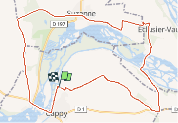
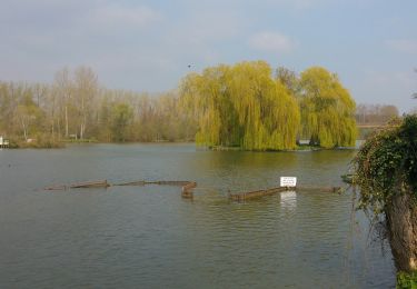
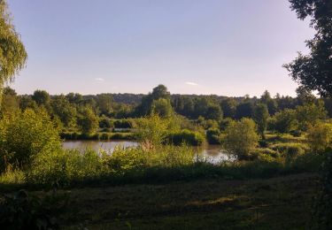
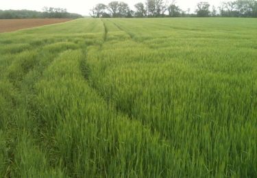
Trail Walking of 12.7 km to be discovered at Hauts-de-France, Somme, Cappy. This trail is proposed by corsinou.

Description

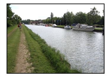
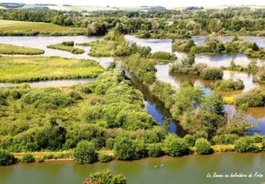
Circuit au départ du cimetière de Cappy, empruntant le chenal de la somme, puis le bois de St Holaire, afin de rejoindre Suzanne et Eclusier Vaux par le bois de Fauvel pour enfin rejoindre Cappy par la Vallée de Péronne

Elevation profile

Positioning

Country:
France
Region :
Hauts-de-France
Department/Province :
Somme
Municipality :
Cappy
Location:
Unknown
Start:(UTM)
482673 ; 5531239 (31U) N.

Trails nearby

Trail Walking Cappy - Les Marais de Suzanne - Cappy - Photo
Walking
tracegps

Walking

Medium
(1)
Cappy, Hauts-de-France, Somme, France
11.2 km | 13.2 km-effort
2h 45min
Yes
Trail Walking Frise - La Montagne de Frise - Photo
Walking
tracegps

Walking

Medium
(1)
Frise, Hauts-de-France, Somme, France
2.2 km | 2.8 km-effort
49min
Yes
Trail On foot Cappy - Les Royards - Photo
On foot
PRO

On foot

Easy
Cappy, Hauts-de-France, Somme, France
8.9 km | 10.4 km-effort
2h 22min
Yes
Trail Walking Curlu - tour des étangs de curlu - Photo
Walking
terminio

Walking

Very easy
Curlu, Hauts-de-France, Somme, France
10.5 km | 11.6 km-effort
2h 41min
Yes
Trail Walking Curlu - Autour des étangs de Curlu et Feuillères - Photo
Walking
terminio

Walking

Easy
(1)
Curlu, Hauts-de-France, Somme, France
11.6 km | 12.7 km-effort
3h 11min
Yes
Trail Other activity Éclusier-Vaux - Vaux - Marais de la Somme - Photo
Other activity
rarnaud

Other activity

Very easy
Éclusier-Vaux, Hauts-de-France, Somme, France
8.7 km | 10.1 km-effort
2h 13min
Yes
Trail Walking Cappy - Les Champs Muraine - Cappy - Photo
Walking
tracegps

Walking

Medium
Cappy, Hauts-de-France, Somme, France
9.9 km | 11.9 km-effort
2h 15min
Yes
Trail Walking Frise - montagne de frise - Photo
Walking
Bernard.voyageur

Walking

Medium
(1)
Frise, Hauts-de-France, Somme, France
2 km | 2.5 km-effort
1h 0min
Yes
Trail Walking Curlu - Le chemin des Automitrailleuses - Curlu - Photo
Walking
tracegps

Walking

Medium
(1)
Curlu, Hauts-de-France, Somme, France
11 km | 12 km-effort
3h 19min
Yes


Close
My subscriptions