


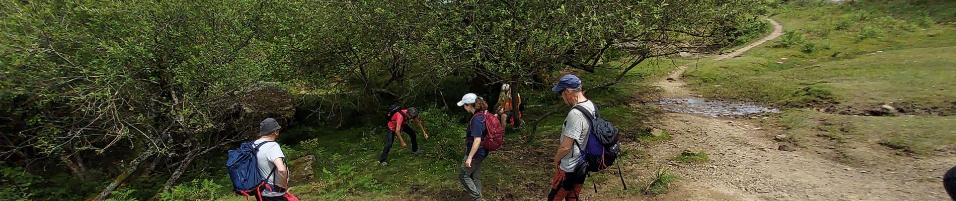
Mondarrain stage

LouisROGER
User GUIDE
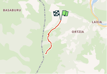

Length
4.3 km

Max alt
646 m

Uphill gradient
283 m
Km-Effort
8.1 km

Min alt
357 m

Downhill gradient
284 m
Boucle
Yes
Creation date :
2024-06-07 11:35:55.458
Updated on :
2024-06-07 14:05:44.08
2h28
Difficulty : Medium

FREE GPS app for hiking
 SityTrail
IGN / Geographical institutes
SityTrail Plus
The world is yours!
About
Trail Walking of 4.3 km to be discovered at New Aquitaine, Pyrénées-Atlantiques, Itxassou. This trail is proposed by LouisROGER.
Photos

Positioning
Country:
France
Region :
New Aquitaine
Department/Province :
Pyrénées-Atlantiques
Municipality :
Itxassou
Location:
Unknown
Start:(Dec)
Start:(UTM)
627978 ; 4796859 (30T) N.
Comments