


camps lamativie

sdroneau
User
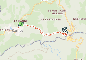

Length
4.1 km

Max alt
562 m

Uphill gradient
67 m
Km-Effort
5.9 km

Min alt
285 m

Downhill gradient
316 m
Boucle
No
Creation date :
2024-06-16 20:50:24.91
Updated on :
2024-06-16 20:50:28.984
1h20
Difficulty : Easy

FREE GPS app for hiking
 SityTrail
IGN / Geographical institutes
SityTrail Plus
The world is yours!
About
Trail Walking of 4.1 km to be discovered at New Aquitaine, Corrèze, Camps-Saint-Mathurin-Léobazel. This trail is proposed by sdroneau.
Positioning
Country:
France
Region :
New Aquitaine
Department/Province :
Corrèze
Municipality :
Camps-Saint-Mathurin-Léobazel
Location:
Unknown
Start:(Dec)
Start:(UTM)
420431 ; 4981651 (31T) N.
Comments