


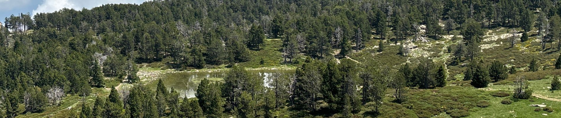
Canigou par la « cheminée »

GeorgesV.
User
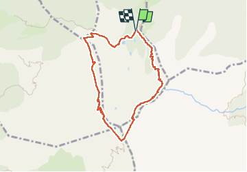

Length
8.4 km

Max alt
2753 m

Uphill gradient
711 m
Km-Effort
17.9 km

Min alt
2153 m

Downhill gradient
710 m
Boucle
Yes
Creation date :
2024-06-26 05:50:52.0
Updated on :
2024-06-26 13:23:35.09

FREE GPS app for hiking
 SityTrail
IGN / Geographical institutes
SityTrail Plus
The world is yours!
About
Trail of 8.4 km to be discovered at Occitania, Pyrénées-Orientales, Taurinya. This trail is proposed by GeorgesV..
Description
Ascension du Canigou depuis le refuge des Coutalets (2ème journée)
Photos

Positioning
Country:
France
Region :
Occitania
Department/Province :
Pyrénées-Orientales
Municipality :
Taurinya
Location:
Unknown
Start:(Dec)
Start:(UTM)
456058 ; 4709242 (31T) N.
Comments