


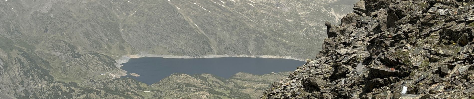
Mont Carlit

GeorgesV.
User
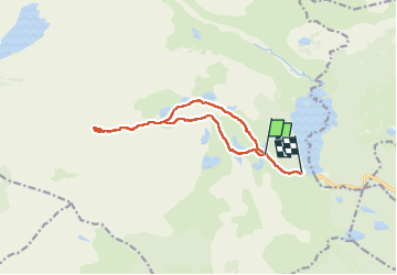

Length
13.3 km

Max alt
2886 m

Uphill gradient
771 m
Km-Effort
24 km

Min alt
2038 m

Downhill gradient
879 m
Boucle
No
Creation date :
2024-06-28 06:24:03.0
Updated on :
2024-06-28 15:04:45.677

FREE GPS app for hiking
 SityTrail
IGN / Geographical institutes
SityTrail Plus
The world is yours!
About
Trail of 13.3 km to be discovered at Occitania, Pyrénées-Orientales, Angoustrine-Villeneuve-des-Escaldes. This trail is proposed by GeorgesV..
Photos


Positioning
Country:
France
Region :
Occitania
Department/Province :
Pyrénées-Orientales
Municipality :
Angoustrine-Villeneuve-des-Escaldes
Location:
Unknown
Start:(Dec)
Start:(UTM)
416700 ; 4712941 (31T) N.
Comments