


2024-07-01_16h47m14_SityTrail - 4107938 - circuit-des-lacs-allos-v1

clintest
User
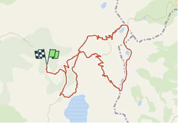

Length
12.9 km

Max alt
2675 m

Uphill gradient
619 m
Km-Effort
21 km

Min alt
2108 m

Downhill gradient
618 m
Boucle
Yes
Creation date :
2024-07-01 14:47:14.729
Updated on :
2024-07-01 14:47:16.351

FREE GPS app for hiking
 SityTrail
IGN / Geographical institutes
SityTrail Plus
The world is yours!
About
Trail of 12.9 km to be discovered at Provence-Alpes-Côte d'Azur, Alpes-de-Haute-Provence, Allos. This trail is proposed by clintest.
Positioning
Country:
France
Region :
Provence-Alpes-Côte d'Azur
Department/Province :
Alpes-de-Haute-Provence
Municipality :
Allos
Location:
Unknown
Start:(Dec)
Start:(UTM)
316173 ; 4901691 (32T) N.
Comments