


Gabas Etsaut

viaul
User GUIDE
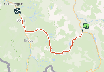

Length
26 km

Max alt
2183 m

Uphill gradient
1286 m
Km-Effort
44 km

Min alt
594 m

Downhill gradient
1729 m
Boucle
No
Creation date :
2024-07-08 05:14:15.0
Updated on :
2024-07-08 17:11:15.295

FREE GPS app for hiking
 SityTrail
IGN / Geographical institutes
SityTrail Plus
The world is yours!
About
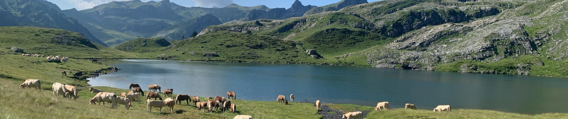
Trail of 26 km to be discovered at New Aquitaine, Pyrénées-Atlantiques, Laruns. This trail is proposed by viaul.
Description
Bcp de route et passages très dangereux mais très belle rando
Photos

Positioning
Country:
France
Region :
New Aquitaine
Department/Province :
Pyrénées-Atlantiques
Municipality :
Laruns
Location:
Unknown
Start:(Dec)
Start:(UTM)
710124 ; 4751477 (30T) N.
Comments