


refuge vanoise/ entre deux eaux

geoffrayLayeux
User
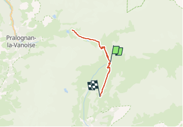

Length
18.7 km

Max alt
2524 m

Uphill gradient
922 m
Km-Effort
30 km

Min alt
2046 m

Downhill gradient
663 m
Boucle
No
Creation date :
2024-07-10 16:40:51.809
Updated on :
2024-07-10 16:40:58.864
6h50
Difficulty : Very difficult

FREE GPS app for hiking
 SityTrail
IGN / Geographical institutes
SityTrail Plus
The world is yours!
About
Trail Walking of 18.7 km to be discovered at Auvergne-Rhône-Alpes, Savoy, Val-Cenis. This trail is proposed by geoffrayLayeux.
Positioning
Country:
France
Region :
Auvergne-Rhône-Alpes
Department/Province :
Savoy
Municipality :
Val-Cenis
Location:
Termignon
Start:(Dec)
Start:(UTM)
331033 ; 5025395 (32T) N.
Comments