


Tour des Gdes Jorasses 5

srdt29
User
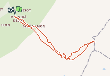

Length
10.5 km

Max alt
2928 m

Uphill gradient
902 m
Km-Effort
22 km

Min alt
2010 m

Downhill gradient
894 m
Boucle
Yes
Creation date :
2019-01-29 19:37:04.93
Updated on :
2020-07-30 18:04:21.615
4h00
Difficulty : Easy

FREE GPS app for hiking
 SityTrail
IGN / Geographical institutes
SityTrail Plus
The world is yours!
About
Trail Other activity of 10.5 km to be discovered at Aosta Valley, Unknown, Courmayeur. This trail is proposed by srdt29.
Description
5ème jour - Ski de randonnée
- Refuge Bonatti 2056m
- Col de Malatra 2928m
- Refuge Bonatti 2056m
Positioning
Country:
Italy
Region :
Aosta Valley
Department/Province :
Unknown
Municipality :
Courmayeur
Location:
Unknown
Start:(Dec)
Start:(UTM)
347298 ; 5078953 (32T) N.
Comments