![](/images/other/stat-length.png)
![Trail Walking Armeau - Armeau - Villeneuve sur Yonne - Photo](https://media.geolcdn.com/t/1900/400/ext.pjpeg?maxdim=2&url=https%3A%2F%2Fstatic1.geolcdn.com%2Fsiteimages%2Fupload%2Ffiles%2F1553511878bg_sport_marche.png)
Armeau - Villeneuve sur Yonne
marcel.F
User
![Length](/images/other/stat-length.png)
Length
19.5 km
![Max alt](https://static1.geolcdn.com/siteimages/upload/files/1508320355ic_sort_altitude_max_24dp.png)
Max alt
187 m
![Uphill gradient](https://static1.geolcdn.com/siteimages/upload/files/1508320355ic_sort_den_pos_24dp.png)
Uphill gradient
339 m
![Km-Effort](/images/other/stat-length.png)
Km-Effort
24 km
![Min alt](https://static1.geolcdn.com/siteimages/upload/files/1508320355ic_sort_altitude_min_24dp.png)
Min alt
68 m
![Downhill gradient](https://static1.geolcdn.com/siteimages/upload/files/1508320355ic_sort_den_neg_24dp.png)
Downhill gradient
339 m
![Boucle](https://static1.geolcdn.com/siteimages/upload/files/16400158638029165_repeat_loop_refresh_sync_direction_icon.png)
Boucle
Yes
Creation date :
2019-04-01 20:24:42.531
Updated on :
2019-04-01 20:24:42.593
![Walking](https://static1.geolcdn.com/sitytour/trail-icons/101.png)
5h11
Difficulty : Medium
![Scan this QR Code to open this trail in the SityTrail application](https://capi.geolives.com/qq0zvz2zws4bq2lad0pu/sitytour/trails/412164/qr.png?size=200)
FREE GPS app for hiking
About
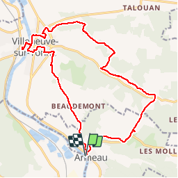
Trail Walking of 19.5 km to be discovered at Bourgogne-Franche-Comté, Yonne, Armeau. This trail is proposed by marcel.F.
Description
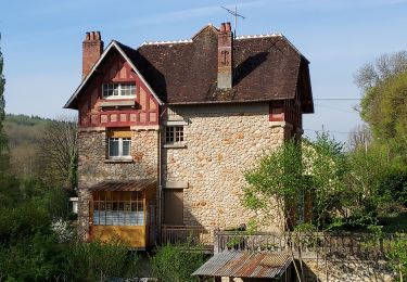
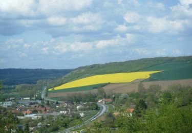
Boucle au départ du centre de vacances "Vallée de l'Yonne" à Armeau
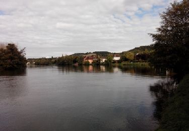
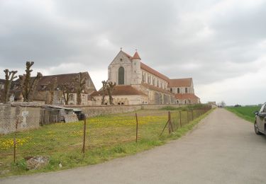
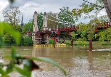
pique-nique au camping de Villeneuve sur Yonne et visite mielerie Donon
Positioning
Country:
France
Region :
Bourgogne-Franche-Comté
Department/Province :
Yonne
Municipality :
Armeau
Location:
Unknown
Start:(Dec)
Start:(UTM)
523825 ; 5321436 (31U) N.
Comments
Trails nearby
![Trail Walking Armeau - Armeau - Photo](https://media.geolcdn.com/t/375/260/ext.jpg?maxdim=2&url=https%3A%2F%2Fservices.sitytrail.com%2FGeolivesWS%2FDownloadMedia.ashx%3FTrailID%3D226655%26Media%3Dfix__20131012120940.jpg)
![Walking Walking](https://static1.geolcdn.com/sitytour/trail-icons/101.png)
Armeau
Walking
Very easy
(2)
Armeau,
Bourgogne-Franche-Comté,
Yonne,
France
![](/images/other/stat-length.png)
11.1 km | 13.4 km-effort
2h 55min
![](https://static1.geolcdn.com/siteimages/upload/files/16400158638029165_repeat_loop_refresh_sync_direction_icon.png)
Yes
![Trail Walking Cézy - Thèmes 9 Km - Photo](https://media.geolcdn.com/t/375/260/ext.jpg?maxdim=2&url=https%3A%2F%2Fstatic1.geolcdn.com%2Fsiteimages%2Fupload%2Ffiles%2F1553511878bg_sport_marche.png)
![Walking Walking](https://static1.geolcdn.com/sitytour/trail-icons/101.png)
Thèmes 9 Km
Walking
Medium
(1)
Cézy,
Bourgogne-Franche-Comté,
Yonne,
France
![](/images/other/stat-length.png)
9.1 km | 11.6 km-effort
2h 29min
![](https://static1.geolcdn.com/siteimages/upload/files/16400158638029165_repeat_loop_refresh_sync_direction_icon.png)
Yes
![Trail Mountain bike Villeneuve-sur-Yonne - 2020-10-23_20h47m43_Randonnée Villeneuve à Villecien - Photo](https://media.geolcdn.com/t/375/260/ext.jpg?maxdim=2&url=https%3A%2F%2Fstatic1.geolcdn.com%2Fsiteimages%2Fupload%2Ffiles%2F1524743154velo.jpg)
![Mountain bike Mountain bike](https://static1.geolcdn.com/sitytour/trail-icons/202.png)
2020-10-23_20h47m43_Randonnée Villeneuve à Villecien
Mountain bike
Difficult
(1)
Villeneuve-sur-Yonne,
Bourgogne-Franche-Comté,
Yonne,
France
![](/images/other/stat-length.png)
35 km | 37 km-effort
2h 33min
![](https://static1.geolcdn.com/siteimages/upload/files/16400158638029165_repeat_loop_refresh_sync_direction_icon.png)
Yes
![Trail Motor Villecien - rando villecien-beon - Photo](https://media.geolcdn.com/t/375/260/ext.jpg?maxdim=2&url=https%3A%2F%2Fstatic1.geolcdn.com%2Fsiteimages%2Fupload%2Ffiles%2F15247431544x4.jpg)
![Motor Motor](https://static1.geolcdn.com/sitytour/trail-icons/400.png)
rando villecien-beon
Motor
Very easy
(1)
Villecien,
Bourgogne-Franche-Comté,
Yonne,
France
![](/images/other/stat-length.png)
32 km | 38 km-effort
Unknown
![](https://static1.geolcdn.com/siteimages/upload/files/16400158638029165_repeat_loop_refresh_sync_direction_icon.png)
No
![Trail Bicycle tourism Villeneuve-sur-Yonne - SEJOUR EN BOURGOGNE - Photo](https://media.geolcdn.com/t/375/260/ext.jpg?maxdim=2&url=https%3A%2F%2Fmedia.geolcdn.com%2Ff%2F528f25d8-abe8-4402-a79c-dc42cab40be5.JPG)
![Bicycle tourism Bicycle tourism](https://static1.geolcdn.com/sitytour/trail-icons/204.png)
SEJOUR EN BOURGOGNE
Bicycle tourism
Very difficult
Villeneuve-sur-Yonne,
Bourgogne-Franche-Comté,
Yonne,
France
![](/images/other/stat-length.png)
127 km | 148 km-effort
Unknown
![](https://static1.geolcdn.com/siteimages/upload/files/16400158638029165_repeat_loop_refresh_sync_direction_icon.png)
No
![Trail Walking Villeneuve-sur-Yonne - 220717 Villeneuve sur Yonne 10,8 km - Photo](https://media.geolcdn.com/t/375/260/ext.jpg?maxdim=2&url=https%3A%2F%2Fmedia.geolcdn.com%2Ff%2F6a9030e7-71f5-4158-a530-e6fbaad03b97.jpg)
![Walking Walking](https://static1.geolcdn.com/sitytour/trail-icons/101.png)
220717 Villeneuve sur Yonne 10,8 km
Walking
Easy
(1)
Villeneuve-sur-Yonne,
Bourgogne-Franche-Comté,
Yonne,
France
![](/images/other/stat-length.png)
11.1 km | 14.1 km-effort
4h 2min
![](https://static1.geolcdn.com/siteimages/upload/files/16400158638029165_repeat_loop_refresh_sync_direction_icon.png)
Yes
![Trail Road bike Saint-Julien-du-Sault - EXT100 St. Julien du Sault-01 - Photo](https://media.geolcdn.com/t/375/260/ext.jpg?maxdim=2&url=https%3A%2F%2Fmedia.geolcdn.com%2Ff%2F91616c53-d73b-4b43-94d7-7072134a06ad.jpg)
![Road bike Road bike](https://static1.geolcdn.com/sitytour/trail-icons/201.png)
EXT100 St. Julien du Sault-01
Road bike
Medium
Saint-Julien-du-Sault,
Bourgogne-Franche-Comté,
Yonne,
France
![](/images/other/stat-length.png)
102 km | 113 km-effort
5h 47min
![](https://static1.geolcdn.com/siteimages/upload/files/16400158638029165_repeat_loop_refresh_sync_direction_icon.png)
Yes
![Trail Walking Villeneuve-sur-Yonne - Les coteaux de l'Yonne - Photo](https://media.geolcdn.com/t/375/260/ext.jpg?maxdim=2&url=https%3A%2F%2Fservices.sitytrail.com%2FGeolivesWS%2FDownloadMedia.ashx%3FTrailID%3D103416%26Media%3D5526_6.jpg)
![Walking Walking](https://static1.geolcdn.com/sitytour/trail-icons/101.png)
Les coteaux de l'Yonne
Walking
Medium
Villeneuve-sur-Yonne,
Bourgogne-Franche-Comté,
Yonne,
France
![](/images/other/stat-length.png)
16.2 km | 20 km-effort
5h 0min
![](https://static1.geolcdn.com/siteimages/upload/files/16400158638029165_repeat_loop_refresh_sync_direction_icon.png)
Yes
![Trail Walking Saint-Aubin-sur-Yonne - St. Aubin sur Yonne 240505 - Photo](https://media.geolcdn.com/t/375/260/ext.jpg?maxdim=2&url=https%3A%2F%2Fmedia.geolcdn.com%2Ff%2F3fc3cdf8-c69a-4209-8730-d1b20b152c3b.jpg)
![Walking Walking](https://static1.geolcdn.com/sitytour/trail-icons/101.png)
St. Aubin sur Yonne 240505
Walking
Difficult
Saint-Aubin-sur-Yonne,
Bourgogne-Franche-Comté,
Yonne,
France
![](/images/other/stat-length.png)
10.7 km | 12.8 km-effort
2h 54min
![](https://static1.geolcdn.com/siteimages/upload/files/16400158638029165_repeat_loop_refresh_sync_direction_icon.png)
Yes