


bouillon.2024.07.16

trusgnachjf
User
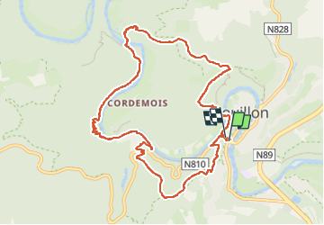

Length
10.6 km

Max alt
381 m

Uphill gradient
450 m
Km-Effort
16.6 km

Min alt
211 m

Downhill gradient
444 m
Boucle
Yes
Creation date :
2024-07-16 07:46:45.174
Updated on :
2024-07-16 12:43:29.381
4h56
Difficulty : Difficult

FREE GPS app for hiking
 SityTrail
IGN / Geographical institutes
SityTrail Plus
The world is yours!
About
Trail Walking of 10.6 km to be discovered at Wallonia, Luxembourg, Bouillon. This trail is proposed by trusgnachjf.
Positioning
Country:
Belgium
Region :
Wallonia
Department/Province :
Luxembourg
Municipality :
Bouillon
Location:
Unknown
Start:(Dec)
Start:(UTM)
648623 ; 5517492 (31U) N.
Comments