


Tour de la Fourche

geoffrayLayeux
User
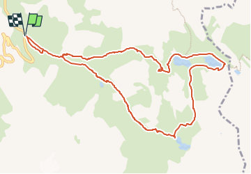

Length
11.5 km

Max alt
2583 m

Uphill gradient
666 m
Km-Effort
20 km

Min alt
1968 m

Downhill gradient
666 m
Boucle
Yes
Creation date :
2024-07-16 17:19:18.253
Updated on :
2024-07-16 17:19:56.198
4h38
Difficulty : Very difficult

FREE GPS app for hiking
 SityTrail
IGN / Geographical institutes
SityTrail Plus
The world is yours!
About
Trail Walking of 11.5 km to be discovered at Auvergne-Rhône-Alpes, Savoy, Valloire. This trail is proposed by geoffrayLayeux.
Positioning
Country:
France
Region :
Auvergne-Rhône-Alpes
Department/Province :
Savoy
Municipality :
Valloire
Location:
Unknown
Start:(Dec)
Start:(UTM)
298210 ; 4996166 (32T) N.
Comments