Trail Walking Val-Cenis - 180724 - Photo
© OpenStreetMap contributors
Length
Length
17 km
Max alt
Max alt
2846 m
Uphill gradient
Uphill gradient
583 m
Km-Effort
Km-Effort  
26 km
Min alt
Min alt
2087 m
Downhill gradient
Downhill gradient
820 m
Boucle
Boucle
No
Creation date :
2024-07-18 07:05:51.22
Updated on :
2024-07-20 05:59:58.952

(0 Reviews)

Walking
Walking
7h44
Difficulty : Very difficult

Scan this QR Code to open this trail in the SityTrail application

FREE GPS app for hiking

Logo SityTrail SityTrail

IGN / Geographical institutes

Download SityTrail from the App Store Download SityTrail from Google Play

Logo SityTrail SityTrail Plus

The world is yours!

Download SityTrail from the App Store Download SityTrail from Google Play Download SityTrail on Huawei AppGallery

About

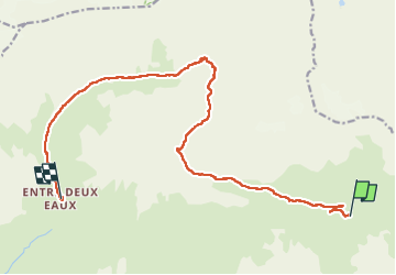
Trail Walking of 17 km to be discovered at Auvergne-Rhône-Alpes, Savoy, Val-Cenis. This trail is proposed by mzonzon05.

Description

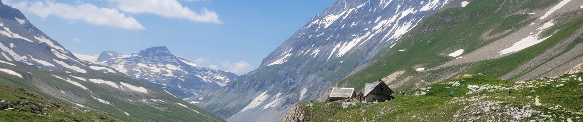
Notre 2ème étape en Vanoise. itinéraire très isolé. Terrain de prédilection des marmottes !
Besoin de faire attention à l'itinéraire qui ne comporte que des cairns.
Paysage somptueux avec notamment une magnifique vue sur l'Arpont

Elevation profile

Photos

Positioning

Country:
France
Region :
Auvergne-Rhône-Alpes
Department/Province :
Savoy
Municipality :
Val-Cenis
Location:
Termignon
Start:(UTM)
337824 ; 5025332 (32T) N.


Close
My subscriptions