


Lacs de Merlet

BernardAF
User
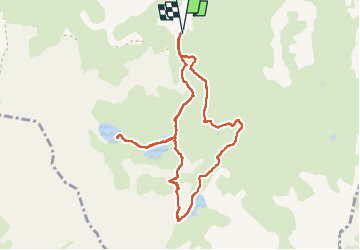

Length
9.5 km

Max alt
2502 m

Uphill gradient
410 m
Km-Effort
15 km

Min alt
2221 m

Downhill gradient
405 m
Boucle
Yes
Creation date :
2024-07-30 07:00:29.837
Updated on :
2024-07-30 11:28:30.6
4h27
Difficulty : Difficult

FREE GPS app for hiking
 SityTrail
IGN / Geographical institutes
SityTrail Plus
The world is yours!
About
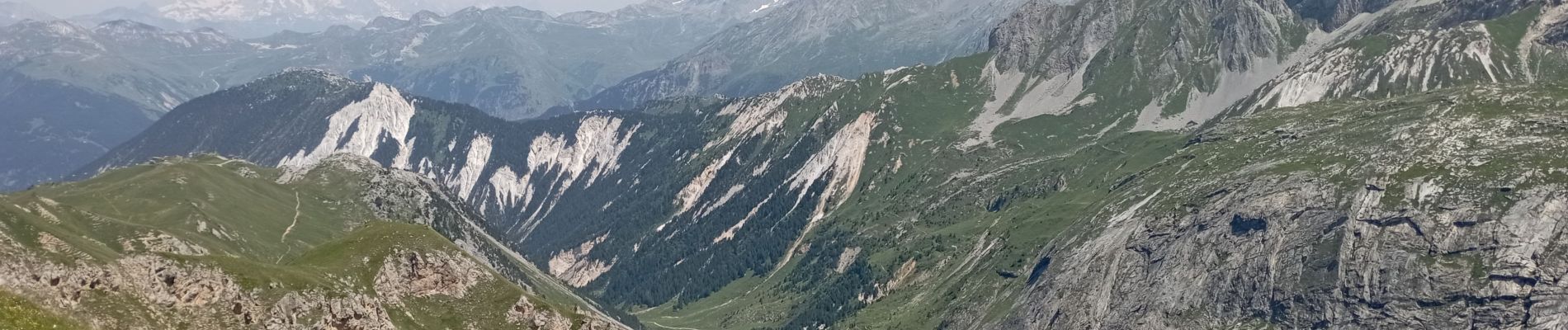
Trail Walking of 9.5 km to be discovered at Auvergne-Rhône-Alpes, Savoy, Courchevel. This trail is proposed by BernardAF.
Description
départ col de la Playa, refuge du grand Plan, lac du pètre, lacs de Merlet.
Photos


Positioning
Country:
France
Region :
Auvergne-Rhône-Alpes
Department/Province :
Savoy
Municipality :
Courchevel
Location:
Saint-Bon-Tarentaise
Start:(Dec)
Start:(UTM)
316210 ; 5027041 (32T) N.
Comments