


T_te_des_Faux

francoisecarlier
User
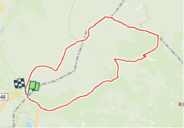

Length
9.9 km

Max alt
1215 m

Uphill gradient
344 m
Km-Effort
14.5 km

Min alt
942 m

Downhill gradient
345 m
Boucle
Yes
Creation date :
2024-07-31 10:57:02.759
Updated on :
2024-07-31 10:57:56.318
3h17
Difficulty : Medium

FREE GPS app for hiking
 SityTrail
IGN / Geographical institutes
SityTrail Plus
The world is yours!
About
Trail Walking of 9.9 km to be discovered at Grand Est, Haut-Rhin, Orbey. This trail is proposed by francoisecarlier.
Positioning
Country:
France
Region :
Grand Est
Department/Province :
Haut-Rhin
Municipality :
Orbey
Location:
Unknown
Start:(Dec)
Start:(UTM)
357809 ; 5333213 (32U) N.
Comments