


24 08 02 à la recherche de myrtille

jmbilger
User
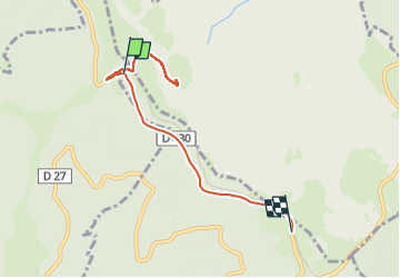

Length
5.8 km

Max alt
1197 m

Uphill gradient
130 m
Km-Effort
7.5 km

Min alt
1116 m

Downhill gradient
125 m
Boucle
No
Creation date :
2024-08-04 15:43:48.0
Updated on :
2024-08-04 17:02:38.61
1h04
Difficulty : Unknown

FREE GPS app for hiking
 SityTrail
IGN / Geographical institutes
SityTrail Plus
The world is yours!
About
Trail Walking of 5.8 km to be discovered at Grand Est, Haut-Rhin, Oderen. This trail is proposed by jmbilger.
Positioning
Country:
France
Region :
Grand Est
Department/Province :
Haut-Rhin
Municipality :
Oderen
Location:
Unknown
Start:(Dec)
Start:(UTM)
350227 ; 5314584 (32T) N.
Comments