


Orceyrette

Nuance
User
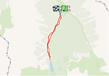

Length
5 km

Max alt
1937 m

Uphill gradient
178 m
Km-Effort
7.3 km

Min alt
1757 m

Downhill gradient
175 m
Boucle
Yes
Creation date :
2024-08-06 09:30:51.0
Updated on :
2024-08-06 18:15:26.269
1h40
Difficulty : Medium

FREE GPS app for hiking
 SityTrail
IGN / Geographical institutes
SityTrail Plus
The world is yours!
About
Trail Walking of 5 km to be discovered at Provence-Alpes-Côte d'Azur, Hautes-Alpes, Villar-Saint-Pancrace. This trail is proposed by Nuance.
Positioning
Country:
France
Region :
Provence-Alpes-Côte d'Azur
Department/Province :
Hautes-Alpes
Municipality :
Villar-Saint-Pancrace
Location:
Unknown
Start:(Dec)
Start:(UTM)
315021 ; 4967804 (32T) N.
Comments